Description:
Exports graphs from Gephi for use with Google Maps API. Similar to browsing maps in Google Maps you can browse graphs the same way. Pre-rendering the graph makes it possible to view even large graphs fluently in browser.
Usage:
* File > Export > Google Maps Exporter
* Open index.html or index2.html in export directory
The exporter will render the graph as PNG tiles and output a HTML and JavaScript files. There are two examples: index.html + ui.js and index2.html + ui2.js. Custom functionality (eg. hovering over a node, clicking a node) can be added with Google Maps API.
Live example at
https://googlemapsexporter.firebaseapp.com/index.html and
https://googlemapsexporter.firebaseapp.com/index2.html

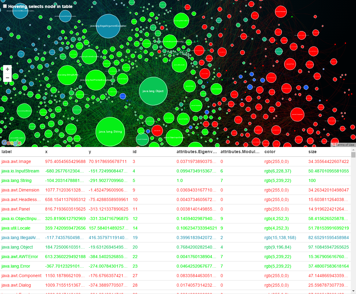
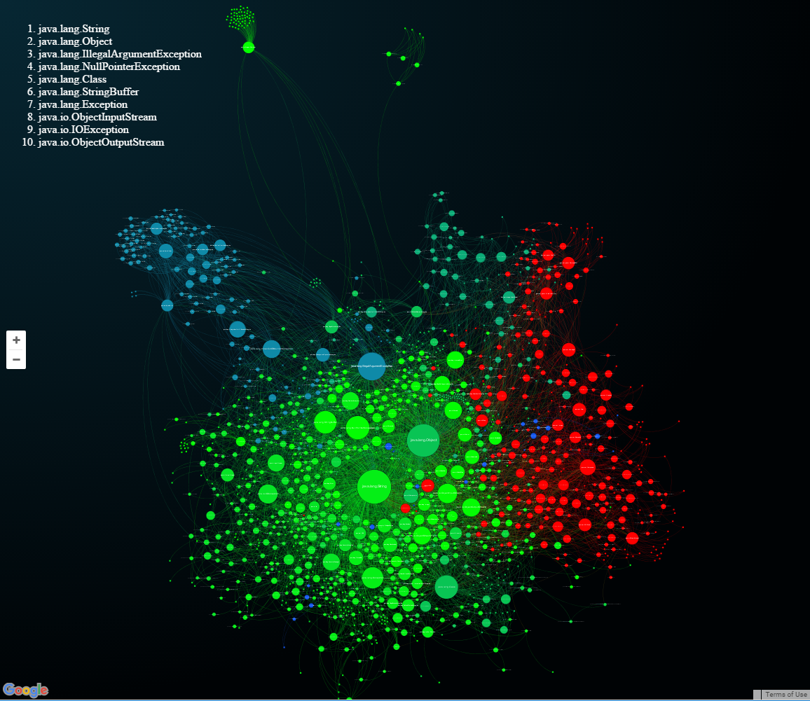
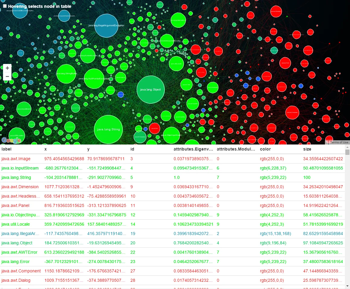
Browsing graph is similar to browsing Google Maps

Visible nodes are updated on the data table below graph. Table is automatically updated while panning and zooming in on the graph. Columns can be ordered.
Author:
Sources:
github.com/pegep/GoogleMapsExporterLicense:
Compatible Gephi versions:
Tools > Pluginsmenu. The following download links may be useful to spread this plugin to people with no internet access, for instance.
Related images: